Day 5 of my trip to Scotland had arrived and it was time to pack up my tent and move on to another campsite, after a quick breakfast I loaded the car and headed off first south along the banks of Loch Lomond, then along the southern edge, stopping off for some supplies in Balloch and then driving up the long western edge of the Loch. I have driven this road before back on highpoint number 100 when I went to Ben Nevis and I remember how beautiful this journey was, for 24 miles the road runs along side of the Loch allowing amazing views across the Loch towards, Ben Lomond, well it would be the case if the weather wasn't this bad, for the last day or so it had been raining pretty hard, I was lucky to get a dry spell at the top of Ben Lomond but generally the weather was very wet and today it was still raining leaving me with a nice view of the clouds. As I drove I had the heating full on trying to dry various items of clothing, especially my walking boots, so as you can imagine it was a rather warm trip.
 |
| The Red Squirrel Campsite |
After passing the Loch, the road continues along through some sparsely populated areas of Scotland, through the forests and across the open land for miles and miles. I stopped off at a shop and service area for a break and a wander around the tourist shop and then I was back on my journey eventually driving across the sweeping plains of Rannoch Moor and finally entering the stunning pass of Glencoe and turning off onto a smaller road finding my campsite for the next 2 nights. The Red Squirrel campsite sits right next to the River Coe and it is a beautiful place with lots of different areas to camp in, I chose a quiet little spot near some trees and set up my tent in the pouring rain, it didn't take me long to set up and I was soon unpacked and off for a drive around the local area. I finished the day off with a walk along the river and a nice meal.
 |
| The Three Sisters |
The next morning it was time to tackle a beast of a mountain, I had breakfast and headed off to a car park next to the road in the Pass of Glencoe, It was still raining on and off so I got on the wet weather gear, collected my back pack of supplies and headed off. The car park was situated across the valley from the route I was taking so the first thing I had to do was descend down from the car park to the valley floor. It was here I noticed a lot of people joining the path ahead of me and heading in the same direction, literally about 30+ people all walking the same way so I imagined I was going to be having some company on the route ahead. After a few minutes of walking with the crowds we reached a river crossing, it was right here that ll those people stopped an turned back leaving me on my own. It was quite a weird feeling at this point, what did they know that I didn't? what was I walking into? Obviously they had just come to look at the river however it was a strange feeling heading off into the unknown.

The path started to ascend now, my route was to take me up the northern most of the famous 3 Sisters valleys of Glencoe, It was still raining a bit but as the path started to enter the valley I did get a bit of shelter which was good, the path was quite steep in places but it was a good path and I made good progress, always climbing up the length of the valley, getting higher and higher. After what seemed like about 4 hours (but was actually only 2 hours) I stopped for a short break to take in the views, Ahead of me the rocks disappeared into the clouds but below me the views were stunning, in the far distance I could still see the tiny car park, the river and path stretching off into the distance, a quick look at the map showed I had gone from the river at about 100 mtr above sea level and I was now at about 550 mtrs above sea level. This meant I had been climbing this steep and slow path for 2 hours and I was now only just half way, I also knew that the path was not going to be getting any easier, time to crack on.

Towards the top of the valley the path crossed a small river and then headed up the side of the valley eventually disappearing altogether leaving me to find my way using the maps alone. The route has become VERY steep here with some scrambling up some difficult slopes and then across areas of marshy land. It felt like I was going the wrong directing for a time because I had to zig zag up the sides of the valley to get to the start of the ridge leading me up. I was now in the cloud and visibility was now very low, the views were gone and it was just me and my thoughts . . . and the rain. 800 mtrs above sea level now and I had turned back to the correct direction, the start of a ridge leading me to a summit and then eventually my destination, the path was back for a while here which made life easy, I had not seen a single person since the valley floor so I was well and truly on my own here.
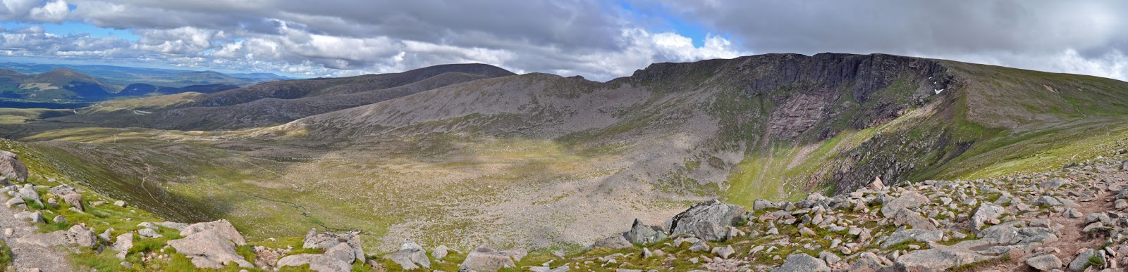
 |
| Stob Coire nan Lochan |
The path continued for about 10 mins and then it abruptly stopped, ahead of me as far as I could see into the cloud was just a field of boulders, the boulders climbed steeply upwards but was sloping down to either side of me, my climb was going to be getting much more difficult. I Started the climb across the boulders and then it hit me, gale force winds from the south literally nearly blew me off my feet, I had obviously reached a point where the shelter of the valley was now gone, Another shock happened when I glanced to my left and saw a vertical drop below me, I made a mental note to stick to the right as I moved along these boulders as I knew that was not so steep. It was hard work, staying on the highest point of the ridge, keeping an eye on the direction of travel and trying not to trip up or get near the vertical drop. For about 20 mins I scrambled over these boulders and then disaster happened, I slipped and ripped half the nail off of my thumb, there I was halfway up a mountain, with my thumb nail hanging off and blood streaming from it. Because of the rain everything was wet, you can imagine if you mix water with blood it goes everywhere, it also looks like you are bleeding about 10 times as much as you actually are.

I always think I am well prepared for all kinds of situations, I was a cub as a youngster so the term 'Be Prepared' was always stuck in my mind, so I sat down, I got my first aid kit out and basically reattached my thumb nail with various plasters and medical tape. I then had a look at the map and noticed I was not too far from the summit of Stob Coire nan Lochan so headed onwards and eventually got there where I could take another stop next to a trig point and asses the situation. After a short stop I continued my walk, a mixture of rough paths, boulders, and lots of scrambling, it was slow and with the rain, gale force winds always trying to blow me over it really was not my idea of a good climb. At last I got to the last final steep scramble up and I had made it to the top, Bidean nam Bian, at 1150 mtrs above sea level it is the highest point of the historic county of Argyll.


I sat down at the top, there was no shelter, just a pile of stones, there was no view and the wind was really full on, I tried to shelter next to the stones but it really was pointless. I did manage to restock my pockets with food and I got in a cup of tea too so all was not lost . . . . . and then, I was lost. I looked around, nothing but white clouds, wind and rain, I looked to my left, I could see nothing, to my right, again nothing, I literally had no idea which direction I came from or which direction I was going to . . . thankfully I do have my compass, this was the first time I have actually needed to rely on it during my highpoints challenge. I took stock of my situation, my plan was to walk a circular route, continue along and then eventually down another of the 3 Sisters valleys. I made a decision, the route had so far been tough, but I managed it and I knew it, so I decided to turn back and retrace my exact same route, so heading back I started my long scramble, this time avoiding any injury and slowly but surely getting back past the summit of Stob Coire nan Lochan and then back down to the easier walking.

Descending down and across some marshy areas i then scrambled down the few steep areas and back across the small river and rejoining the path back down the side of the valley. My knees were starting to play up along here, they often do when going down steps so I took it slow and I managed to keep the knee problem at bay, about half way down the valley I saw my first people for what seemed like hours, an eager couple who excitedly asked how far it was to the top, when I told them about 3 or 4 hours they gasped and said "I think we will enjoy the view from here". Although it was a LONG walk down the side of the valley, the views were amazing, it was nice to be out of the cloud cover again, it was wonderful seeing ll the tiny cars and ant like people scurrying about below. Reaching the bottom of the valley I crossed the bridge and then had to make one last painful climb back up to the car park,
Back at the campsite I had a wonderful shower, a lovely dinner and then I slept for a really long time time, it was still raining, my hand was in pain from the injury too but I was so tired, nothing was going to stop me from sleeping.
to be continued . . . . . . . . . .


 Back at the campsite I had a bit of a rest and shower and then I headed into Aviemore with Duncan to grab some food in one of the local restaurants, an Australian themed place called Roo's Leep. then it was off back to the campsite for a well earned sleep. After the rain of the last 4 days Ben Macdui turned out to be a really wonderful climb and it was great to have the company of Duncan on the walk too.